Computer Vision · Graduation Project
Building Height Detection from Satellite Images
A two-stage computer vision pipeline that segments buildings from RGB satellite imagery and estimates their heights.
Context
Graduation Project
Role
Graduation Project
Year
2026
Stack
PyTorchOpenCVAlbumentationssegmentation_models_pytorchDeep Learning
Problem
What needed solving
Accurate building heights matter for urban planning and 3D city modeling, but ground-truth height data such as LIDAR or survey data is expensive and rarely available outside major cities, while RGB satellite imagery is comparatively cheap and widely available.
What I built
Concrete responsibilities
- A building segmentation stage that predicts building footprints from RGB satellite tiles
- A pixel-wise height regression stage that estimates building heights from the segmented footprints
- A benchmarking pass across multiple segmentation architectures to select the strongest baseline
- A custom inference and analytics GUI for running the pipeline and inspecting predictions
System
How it fits together
Satellite tiles are first passed through a segmentation stage that predicts building footprints, then a pixel-wise regression stage estimates height for the segmented buildings. I benchmarked the segmentation stage across several architectures, including U-Net based approaches, DeepLabV3+, EfficientNet-B4 encoders, FPN, SegFormer and HRNet-related variants, before settling on the strongest performer.
Key technical decisions
What was interesting or non-trivial
Split the problem into segmentation then regression instead of one end-to-end model.
More pipeline stages to maintain, but each stage became easier to debug and benchmark independently.
Result
What the system produced
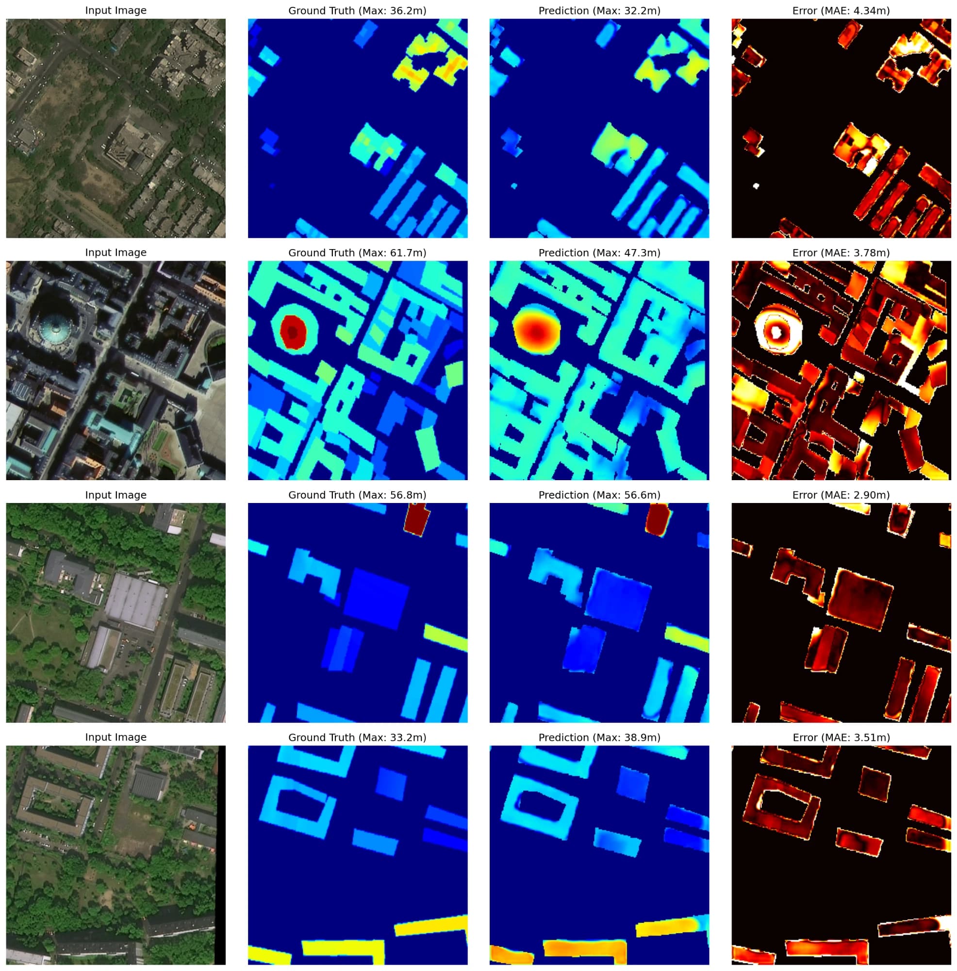
A working two-stage pipeline that produces a building segmentation mask and a per-building height estimate from a satellite tile, submitted as my graduation project.
Segmentation IoU
76.47%
Segmentation F1
81.1%
Height MAE
3.54 m
Height R²
0.72
Across segmentation and height-estimation stages, reported evaluation included 76.47% IoU and 81.1% F1 for segmentation, and 3.54 m MAE with an R² of 0.72 for height regression. The two stages were evaluated separately, not as a single combined score.
What I learned
How much of applied computer vision work is about data preparation and normalization across tiles, not just model architecture.